No products
Prices are tax included
Product successfully added to your shopping cart
There are 0 items in your cart. There is 1 item in your cart.
Archéologie du Paysage
- Archéologie et Histoire Romaine
- Archéologie Moderne et Contemporaine
- Archéologie des Plantes et des Animaux
- Archéologie du Paysage
- Archives & Histoire de l'Archéologie
- Europe Médiévale
- Monographies Instrumentum
- Préhistoires
- Protohistoire européenne
- Research Protocols
- Off collections
- Résonances
- Les cahiers de saint-michel de Cuxa
- Second-hand
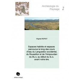
 View larger
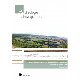
NEW GLIMPSES OF A HIDDEN LANDSCAPE IN THE SURROUNDINGS OF MONT LASSOIS
AP-04
New
Lukas Goldmann. AP-04. New glimpses of a hidden landscape in the surroundings of Mont Lassois. Analyses of survey data in the proximity of the iron age sites at Vix with special consideration of the geomagnetic surveys of the german archeological institute 2013-2016. Préf. B. Chaume, 2021, 274 p., ill. (ISBN : 978-2-35518-111-5)
Recherches menées dans le cadre du P.C.R. « Vix et son environnement » et de l’U.M.R. 6298 ARTEHIS, avec le soutien financier de la Société Archéologique et Historique du Châtillonnais.
More info
The area around Mont Lassois and the village of Vix (Côte-d‘Or) has been the subject of archaeological research for more than a hundred years and yielded a number of unique finds and excavated structures, most notably the famous burial of the “Princesse de Vix”. In addition, decades of prospections, and aerial archaeology in particular, made the region one of the best investigated archaeological landscapes in Europe. In recent years, this research was intensified and bundled within the joint framework of the PCR “Vix et son Environnement”.
In collaboration with the PCR the German Archaeological Institute has conducted largescale, high-resolution geomagnetic surveys around Mont Lassois since 2013, providing valuable insights into a hidden cultural landscape.
The focus of this thesis is on the analyses and interpretation of the data obtained during the 2013 to 2016 campaigns in comparison with the known archaeological sites from the area, as well as other data, such as aerial images, LiDAR scans and geological maps.
Different methods of automated data analyses, vectorisation and data integration using Geographic Information Systems have been employed to interpret this plethora of data, their potential and limitations are discussed in the theoretical part of this thesis. The combined analysis and application of these different datasets and methods revealed, among other features, new burial structures as well as so far unknown settlement areas. These results underline the important role of large-scale geophysical surveys for our understanding archaeological landscapes.
This study was supported by and based on the work and data of the German Archaeological Institute as well as the PCR “Vix et son Environnement” and submitted at the Freie Universität Berlin in 2018.
PRÉFACE
1. Introduction
2. The Mont Lassois - an overview
2.1. Location, geology and natural resources
2.2. History of archaeological research
2.3. History of the survey activities in the area
2.4. The Mont Lassois during the Iron Age
2.5. Discussion - The Mont Lassois as a Fürstensitz
2.6. The archaeology of the Châtillonnais - a look apart from the Iron Age
3. Basis of data
3.1. Aerial images
3.2. LiDAR
3.3. Geomagnetic surveys
4. Technical aspects
4.1. Basic principles of geomagnetic surveying
4.2. Remarks on the measurement Technique
4.3. Data processing
4.4. Data integration
5. Analyses
5.1. Vectorization
5.2. Classification
6. Interpretation
6.1. Area A - Appendix 6.1
6.2. Area B - Appendix 6.2
6.3. Area C - Appendix 6.3
6.4. Area D - Appendix 6.4
6.5. Area E - Appendix 6.5
6.6. Area F - Appendix 6.6
6.7. Area G - Appendix 6.7
6.8. Area H - Appendix 6.8
6.9. Area I - Appendix 6.9
6.10. Area J - Appendix 6.10
6.11. Area K - Appendix 6.11
6.12. Area L - Appendix 6.12
6.13. Area M - Appendix 6.13
6.14. Area N - Appendix 6.14
6.15. Area O - Appendix 6.15
6.16. Results - Appendix 6.16
7. Recommendations for future survey planning
8. Conclusion
8.1. Concluding remarks
8.2. Prospects
9. Bibliography
II. APPENDICES
General Appendix
Appendix 2 - Archaeological site
Appendix 4 - Data Processing and Integration
Appendix 5 - Data Analyses and Classification
Appendix 6.1 - Area A
Appendix 6.2 - Area B
Appendix 6.3 - Area C
Appendix 6.4 - Area D
Appendix 6.5 - Area E
Appendix 6.6 - Area F
Appendix 6.7 - Area G
Appendix 6.8 - Area H
Appendix 6.9 - Area I
Appendix 6.10 - Area J
Appendix 6.11 - Area K
Appendix 6.12 - Area L
Appendix 6.13 - Area M
Appendix 6.14 - Area N
Appendix 6.15 - Area O
Appendix 6.16 - Results
Appendix 7 - Future survey planning